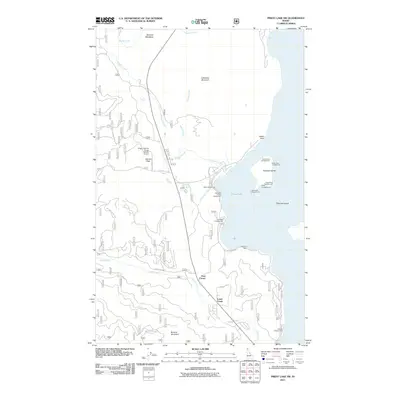
2011 Map of Priest Lake SW
USGS Topo · Published 2011About this map
Priest Lake dominates the eastern edge of this landscape, its shoreline dotted with recreational sites like the Luby Bay Campground and Priest Lake Marina. The rugged Idaho interior is defined by steep elevations reaching up to Lakeview Mountain in the north and Binarch Mountain in the south, separated by drainage basins including Kalispell Creek and Lamb Creek. Small settlements and landmarks such as Hanna Flats and Vans Corner are connected by a network of forest roads and local routes like Hanna Flats Rd. Local history is visible in the presence of the Woodrat Mine and the Priest Lake-US Forest Service Airport, reflecting the region's intersection of natural resource extraction, aviation, and wilderness management. Off the coast, Kalispell Island and Papoose Island stand as prominent features within the lake's reach.
Find a feature on this map
33 named features on this map. Tap any name to fly to it.
Don’t see what you’re looking for? This feature index may not catch every label — zoom into the map to look around manually.
Map Details
Editions of this 2011 Priest Lake SW Map
This is the sole edition of this map. No revisions or reprints were ever made.
Other maps of this area

1901 · Sandpoint
USGS Topo · 1:125,000

1911 · Priest Lake
USGS Topo · 1:250,000

1911 · Sandpoint
USGS Topo · 1:125,000

1913 · Priest Lake
USGS Topo · 1:250,000

1934 · Metaline
USGS Topo · 1:125,000

1936 · Newport
USGS Topo · 1:96,000

1942 · Metaline
USGS Topo · 1:125,000

1942 · Newport
USGS Topo · 1:125,000

1958 · Sandpoint
USGS Topo · 1:250,000

1963 · Sandpoint
USGS Topo · 1:250,000