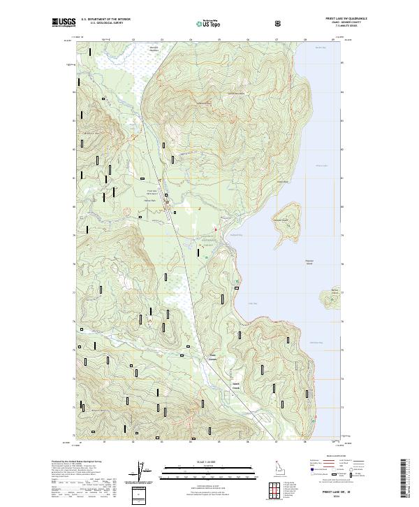
2024 Map of Priest Lake SW
USGS Topo · Published 2024About this map
Priest Lake dominates the eastern edge of this landscape, its shoreline defined by a series of prominent bays including Reeder Bay, Kalispell Bay, Luby Bay, and Shoshone Bay. The interior terrain is characterized by the high peaks of the Selkirk Mountains, where Bismark Mtn, Lakeview Mtn, and Binarch Mtn overlook the western drainages. Within these valleys, smaller water bodies like Hager Lake and the marshy Bismark Meadows suggest the glaciated history of the Kaniksu National Forest. Human activity is concentrated along the lakefront and the State Highway 57 corridor, where the small settlements of Hanna Flats, Vans Corner, and Lamb Creek are located. The presence of the Priest Lake USFS Airport and a dense network of Forest Service roads, such as Nat For Dev Rd 1355 and Nat For Dev Rd 2519, highlights the area's role as a hub for both aviation and timber management in the Panhandle.
Find a feature on this map
50 named features on this map. Tap any name to fly to it.
Don’t see what you’re looking for? This feature index may not catch every label — zoom into the map to look around manually.
Map Details
Editions of this 2024 Priest Lake SW Map
This is the sole edition of this map. No revisions or reprints were ever made.
Other maps of this area

1901 · Sandpoint
USGS Topo · 1:125,000

1911 · Priest Lake
USGS Topo · 1:250,000

1911 · Sandpoint
USGS Topo · 1:125,000

1913 · Priest Lake
USGS Topo · 1:250,000

1934 · Metaline
USGS Topo · 1:125,000

1936 · Newport
USGS Topo · 1:96,000

1942 · Metaline
USGS Topo · 1:125,000

1942 · Newport
USGS Topo · 1:125,000

1958 · Sandpoint
USGS Topo · 1:250,000

1963 · Sandpoint
USGS Topo · 1:250,000