
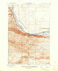
1917 Map of Priest Rapids
USGS Topo · Published 1917About this map
Columbia River white water and the expansive Rattlesnake Hills dominate this early twentieth-century survey of south-central Washington. The landscape is defined by the sharp bend of the river at Priest Rapids, where an early Power Plant stands near the Chicago Milwaukee and St Paul railroad line. This period shows a sparse but organized network of remote outposts and river crossings, including Richmond Ferry and the riverside settlement of Vernita.
Find a feature on this map
36 named features on this map. Tap any name to fly to it.
Don’t see what you’re looking for? This feature index may not catch every label — zoom into the map to look around manually.
Map Details
Editions of this 1917 Priest Rapids Map
2 editions found
Other maps of this area

1910 · Zillah
USGS Topo · 1:125,000

1911 · Red Rock
USGS Topo · 1:62,500

1912 · Beverly
USGS Topo · 1:62,500

1915 · Prosser
USGS Topo · 1:125,000

1916 · Coyote Rapids
USGS Topo · 1:62,500

1917 · Prosser
USGS Topo · 1:125,000

1936 · Hog Ranch Buttes
USGS Topo · 1:48,000

1939 · Boylston
USGS Topo · 1:48,000

1941 · Black Rock Spring
USGS Topo · 1:62,500

1943 · Boylston
USGS Topo · 1:62,500