
1948 Map of Priest Rapids
USGS Topo · Published 1958About this map
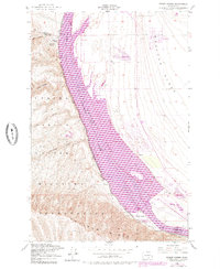
The Columbia River carves a dramatic path through the landscape of the mid-20th century, separating the rising Wahluke Slope from the rugged terrain of the Yakima Firing Center Military Reservation. This survey captures the river before its modern transformation, highlighting the turbulent Priest Rapids and the industrial infrastructure associated with the Powerhouse and nearby Station. The rail lines of the Chicago Milwaukee St Paul and Pacific flank the western shore, following the base of Umtanum Ridge and passing through several drainage cuts including Alkali Canyon and Corral Canyon.
Find a feature on this map
24 named features on this map. Tap any name to fly to it.
Don’t see what you’re looking for? This feature index may not catch every label — zoom into the map to look around manually.
Map Details
Editions of this 1948 Priest Rapids Map
2 editions found
Other maps of this area

1912 · Beverly
USGS Topo · 1:62,500

1917 · Priest Rapids
USGS Topo · 1:62,500

1936 · Hog Ranch Buttes
USGS Topo · 1:48,000

1939 · Boylston
USGS Topo · 1:48,000

1941 · Black Rock Spring
USGS Topo · 1:62,500

1943 · Boylston
USGS Topo · 1:62,500

1948 · Cairn Hope Peak
USGS Topo · 1:24,000

1948 · Emerson Nipple
USGS Topo · 1:24,000

1950 · Yakima
USGS Topo · 1:250,000

1951 · Priest Rapids
USGS Topo · 1:62,500