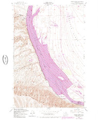
1948 Map of Priest Rapids
USGS Topo · Published 1979About this map
Priest Rapids Lake dominates this mid-century landscape, a significant reservoir on the Columbia River that reshaped the local environment between the Wahluke Slope and the Umtanum Ridge. The map details the technical infrastructure of the era, including the Power House, a Fish Ladder, and a Fish Hatchery, alongside the large Priest Rapids Wildlife Recreation Area. To the west, the expansive Yakima Firing Center Military Reservation covers a terrain of deep drainages like Cow Canyon and Sourdough Canyon.
Find a feature on this map
32 named features on this map. Tap any name to fly to it.
Don’t see what you’re looking for? This feature index may not catch every label — zoom into the map to look around manually.
Map Details
Editions of this 1948 Priest Rapids Map
2 editions found
Other maps of this area

1912 · Beverly
USGS Topo · 1:62,500

1917 · Priest Rapids
USGS Topo · 1:62,500

1936 · Hog Ranch Buttes
USGS Topo · 1:48,000

1939 · Boylston
USGS Topo · 1:48,000

1941 · Black Rock Spring
USGS Topo · 1:62,500

1943 · Boylston
USGS Topo · 1:62,500

1948 · Cairn Hope Peak
USGS Topo · 1:24,000

1948 · Emerson Nipple
USGS Topo · 1:24,000

1948 · Priest Rapids
USGS Topo · 1:24,000

1950 · Yakima
USGS Topo · 1:250,000