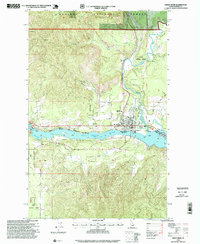
1996 Map of Priest River
USGS Topo · Published 1999About this map
Pend Oreille River and its namesake tributary dominate this landscape, meeting at the city of Priest River. By the mid-1990s, this area reflects a mix of timber industry legacy and public recreation, evidenced by a Sawmill and the Priest River Equestrian Park. The Albeni Falls Dam and Albeni Cove define the western waters, while Strong Island sits mid-stream in the wide Pend Oreille River.
Find a feature on this map
35 named features on this map. Tap any name to fly to it.
Don’t see what you’re looking for? This feature index may not catch every label — zoom into the map to look around manually.
Map Details
Editions of this 1996 Priest River Map
This is the sole edition of this map. No revisions or reprints were ever made.
Other maps of this area

1901 · Sandpoint
USGS Topo · 1:125,000

1911 · Priest Lake
USGS Topo · 1:250,000

1911 · Sandpoint
USGS Topo · 1:125,000

1913 · Priest Lake
USGS Topo · 1:250,000

1936 · Newport
USGS Topo · 1:96,000

1942 · Newport
USGS Topo · 1:125,000

1958 · Sandpoint
USGS Topo · 1:250,000

1963 · Sandpoint
USGS Topo · 1:250,000

1967 · Quartz Mtn
USGS Topo · 1:24,000

1967 · Prater Mtn
USGS Topo · 1:24,000