
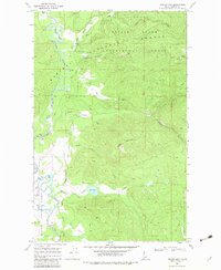
1967 Map of Prater Mtn
USGS Topo · Published 1971About this map
Priest River Experimental Forest dominates this northern Idaho landscape, where forestry research and resource management are central to the terrain. The presence of the Experimental Forest Headquarters and specialized infrastructure like the Sewage Disposal Pond highlight the institutional nature of this mountain tract during the late 1960s. Along the western edge, the river snakes through the timberland, marked by navigational points such as Mile 24 and Mile 13, while McAbee Falls provides a distinct natural landmark.
Find a feature on this map
31 named features on this map. Tap any name to fly to it.
Don’t see what you’re looking for? This feature index may not catch every label — zoom into the map to look around manually.
Map Details
Editions of this 1967 Prater Mtn Map
2 editions found
Other maps of this area

1901 · Sandpoint
USGS Topo · 1:125,000

1911 · Priest Lake
USGS Topo · 1:250,000

1911 · Sandpoint
USGS Topo · 1:125,000

1913 · Priest Lake
USGS Topo · 1:250,000

1958 · Sandpoint
USGS Topo · 1:250,000

1963 · Sandpoint
USGS Topo · 1:250,000

1967 · Quartz Mtn
USGS Topo · 1:24,000

1967 · Coolin
USGS Topo · 1:24,000
1967 · Outlet Bay
USGS Topo · 1:24,000
1968 · Happy Fork Gap
USGS Topo · 1:24,000