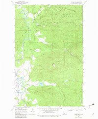
1967 Map of Prater Mtn
USGS Topo · Published 1983About this map
The Priest River Experimental Forest dominates this section of the Idaho panhandle, serving as a hub for silvicultural research within the Kaniksu National Forest. The landscape is defined by the winding course of the Priest River, which meanders through a valley floor dotted with several Gravel Pit sites. Key administrative and local markers include the Experimental Forest Headquarters and the isolated Halfway House near Big Creek.
Find a feature on this map
25 named features on this map. Tap any name to fly to it.
Don’t see what you’re looking for? This feature index may not catch every label — zoom into the map to look around manually.
Map Details
Editions of this 1967 Prater Mtn Map
2 editions found
Other maps of this area

1901 · Sandpoint
USGS Topo · 1:125,000

1911 · Priest Lake
USGS Topo · 1:250,000

1911 · Sandpoint
USGS Topo · 1:125,000

1913 · Priest Lake
USGS Topo · 1:250,000

1958 · Sandpoint
USGS Topo · 1:250,000

1963 · Sandpoint
USGS Topo · 1:250,000

1967 · Quartz Mtn
USGS Topo · 1:24,000

1967 · Coolin
USGS Topo · 1:24,000
1967 · Outlet Bay
USGS Topo · 1:24,000

1967 · Prater Mtn
USGS Topo · 1:24,000