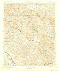
1915 Map of Priest Valley
USGS Topo · Published 1927About this map
New Idria and the surrounding Diablo Range foothills anchor this 1915 study of the rugged borderlands where San Benito, Monterey, and Fresno counties meet. The landscape is defined by an intensive mining economy, prominently featuring the Alpine Mine, Picacho Mine, and Gem Mine near San Benito Mtn, alongside the Monterey Coal Mine to the northwest. These industrial outposts are balanced by a network of one-room schoolhouses serving remote ranching communities, including Columbus School, Bitterwater School, and Tully School.
Find a feature on this map
109 named features on this map. Tap any name to fly to it.
Don’t see what you’re looking for? This feature index may not catch every label — zoom into the map to look around manually.
Map Details
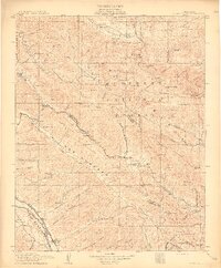
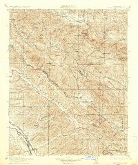
Editions of this 1915 Priest Valley Map
5 editions found

Other maps of this area

1912 · Coalinga
USGS Topo · 1:125,000

1912 · San Ardo
USGS Topo · 1:31,680

1913 · Panoche
USGS Topo · 1:125,000

1914 · Cholame
USGS Topo · 1:125,000

1915 · Priest Valley
USGS Topo · 1:125,000

1915 · Cholame
USGS Topo · 1:125,000

1917 · Cholame
USGS Topo · 1:125,000

1919 · San Miguel
USGS Topo · 1:62,500

1919 · King City
USGS Topo · 1:62,500

1919 · San Benito
USGS Topo · 1:62,500