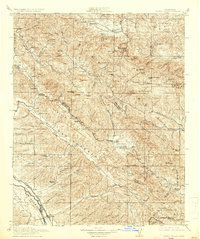
1915 Map of Priest Valley
USGS Topo · Published 1937About this map
New Idria and the nearby Idria P.O. stand as significant hubs in this rugged interior landscape where industrial extraction and ranching defined the early 20th-century economy. The topography is dominated by the Mustang Ridge and Joaquin Ridge, with numerous specialized mines such as the Monterey Coal Mine, Picacho Mine, and Alpine Mine punctuating the mountain slopes. The survey captures a network of rural school districts, including Columbus School, Tully School, and Paris School, reflecting the scattered settlement patterns of family ranchers and miners in the canyon valleys.
Find a feature on this map
93 named features on this map. Tap any name to fly to it.
Don’t see what you’re looking for? This feature index may not catch every label — zoom into the map to look around manually.
Map Details
Editions of this 1915 Priest Valley Map
5 editions found
Other maps of this area

1912 · Coalinga
USGS Topo · 1:125,000

1912 · San Ardo
USGS Topo · 1:31,680

1913 · Panoche
USGS Topo · 1:125,000

1914 · Cholame
USGS Topo · 1:125,000

1915 · Priest Valley
USGS Topo · 1:125,000

1915 · Cholame
USGS Topo · 1:125,000

1917 · Cholame
USGS Topo · 1:125,000

1919 · San Miguel
USGS Topo · 1:62,500

1919 · King City
USGS Topo · 1:62,500

1919 · San Benito
USGS Topo · 1:62,500