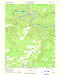
1969 Map of Prince
USGS Topo · Published 1972About this map
The New River carves a dramatic oxbow through this Raleigh and Fayette County landscape, anchored by the engineering of the C & O railroad. Industrial activity is pervasive along the riverbanks, where the settlements of Quinnimont, Prince, and Royal reflect the region's coal and transit history. At Terry, a complex conveyor and Tipple system facilitates coal transport from the surrounding strip mines that mark the ridges of Highland Mountain and Batoff Mountain.
Find a feature on this map
68 named features on this map. Tap any name to fly to it.
Don’t see what you’re looking for? This feature index may not catch every label — zoom into the map to look around manually.
Map Details
Editions of this 1969 Prince Map
4 editions found
Other maps of this area

1887 · Hinton
USGS Topo · 1:125,000

1891 · Raleigh
USGS Topo · 1:125,000

1892 · Hinton
USGS Topo · 1:125,000

1897 · Raleigh
USGS Topo · 1:125,000

1902 · Raleigh
USGS Topo · 1:125,000

1911 · Flattop
USGS Topo · 1:48,000

1911 · Beckley
USGS Topo · 1:48,000

1912 · Meadow Creek
USGS Topo · 1:48,000

1912 · Big Bend
USGS Topo · 1:62,500

1913 · Beckley
USGS Topo · 1:62,500