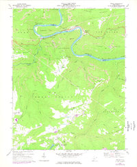
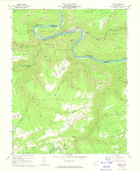
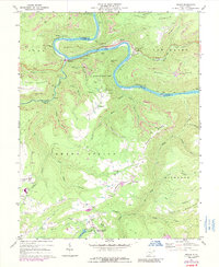
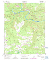
1969 Map of Prince
USGS Topo · Published 1977About this map
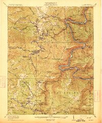
The New River carves a deep, sinuous path through the coalfields of Fayette and Raleigh counties, defining the industrial and recreational geography of this region. The Chesapeake and Ohio railroad clings to the riverbank, passing through the Stretcher Neck Tunnel and serving the rail-dependent settlements of Prince and Quinnimont. This era shows a landscape in transition, where legacy industry like the Tipple near Terry and numerous hilltop strip mines exist alongside the developing parklands of Grandview State Park. In the southern portion of the map, the higher plateaus host local landmarks such as the County Memorial Airport and Table Rock Ch. The integration of heavy extraction and public leisure is evident in the proximity of active quarries to the waters of Little Beaver L within Little Beaver State Park.
Find a feature on this map
66 named features on this map. Tap any name to fly to it.
Don’t see what you’re looking for? This feature index may not catch every label — zoom into the map to look around manually.
Map Details
Editions of this 1969 Prince Map
4 editions found
Other maps of this area

1887 · Hinton
USGS Topo · 1:125,000

1891 · Raleigh
USGS Topo · 1:125,000

1892 · Hinton
USGS Topo · 1:125,000

1897 · Raleigh
USGS Topo · 1:125,000

1902 · Raleigh
USGS Topo · 1:125,000

1911 · Flattop
USGS Topo · 1:48,000

1911 · Beckley
USGS Topo · 1:48,000

1912 · Meadow Creek
USGS Topo · 1:48,000

1912 · Big Bend
USGS Topo · 1:62,500
1913 · Beckley
USGS Topo · 1:62,500