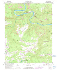
1969 Map of Prince
USGS Topo · Published 1989About this map
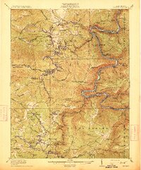
New River serpentine loops dominate this West Virginia landscape, cutting a deep gorge through the Plateau and separating Raleigh and Fayette counties. This 1969 survey, updated with 1980s aerial data, documents a region defined by industrial extraction and the emerging preservation of its natural landmarks. Heavy rail infrastructure, including the C & O RR, follows the river's edge to serve the settlements of Prince and Quinnimont.
Find a feature on this map
55 named features on this map. Tap any name to fly to it.
Don’t see what you’re looking for? This feature index may not catch every label — zoom into the map to look around manually.
Map Details
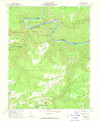
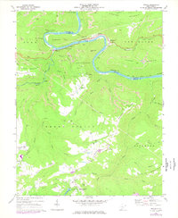
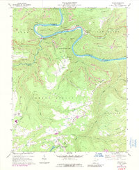
Editions of this 1969 Prince Map
4 editions found
Other maps of this area

1887 · Hinton
USGS Topo · 1:125,000

1891 · Raleigh
USGS Topo · 1:125,000

1892 · Hinton
USGS Topo · 1:125,000

1897 · Raleigh
USGS Topo · 1:125,000

1902 · Raleigh
USGS Topo · 1:125,000

1911 · Flattop
USGS Topo · 1:48,000

1911 · Beckley
USGS Topo · 1:48,000

1912 · Meadow Creek
USGS Topo · 1:48,000

1912 · Big Bend
USGS Topo · 1:62,500
1913 · Beckley
USGS Topo · 1:62,500