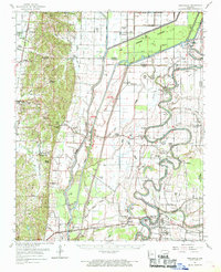
1962 Map of Princedale
USGS Topo · Published 1968About this map
Poinsett Ridge rises as a prominent topographical feature in the western portion of this Arkansas Delta landscape, dividing the rolling upland from the low-lying alluvial plains to the east. The St Francis River winds through a complex system of sloughs and channels, including Hog Slough and Fortune Slough, within the wide Floodway. This era of the early 1960s reveals a deeply rural community structured around small settlements like Princedale and Togo, and a dense network of country churches such as Macedonia Ch and New Hope Ch. The Missouri Pacific railroad serves as a primary transit corridor, passing through Parkin and the Cherry Valley Halt. Cultural history is visible in the landscape via numerous Indian Mounds and family-linked locations like the Yarbo Place and Love Place, while an extensive system of numbered ditches, such as Ditch No 78, highlights the critical role of water management in this agricultural region.
Find a feature on this map
119 named features on this map. Tap any name to fly to it.
Don’t see what you’re looking for? This feature index may not catch every label — zoom into the map to look around manually.
Map Details
Editions of this 1962 Princedale Map
This is the sole edition of this map. No revisions or reprints were ever made.
Other maps of this area

1939 · Vanndale
USGS Topo · 1:62,500

1939 · Weiner
USGS Topo · 1:62,500

1939 · Wynne
USGS Topo · 1:62,500

1939 · Edmondson
USGS Topo · 1:62,500

1940 · Deckerville
USGS Topo · 1:62,500

1940 · Princedale
USGS Topo · 1:62,500

1940 · Whitmore
USGS Topo · 1:62,500

1940 · Dee
USGS Topo · 1:62,500

1941 · Marked Tree
USGS Topo · 1:62,500

1953 · Memphis
USGS Topo · 1:250,000