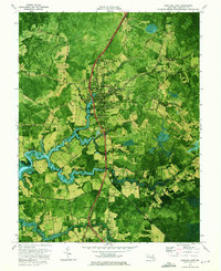
1972 Map of Princess Anne
USGS Topo · Published 1975About this map
The Princess Anne settlement serves as the focal point of this Somerset County landscape, defined by its position along the Penn Central railroad and the winding course of the Manokin River. The map highlights a significant educational and institutional presence, featuring the Univ of Maryland Eastern Shore and Washington High Sch. Moving south from the town center, the terrain is characterized by agricultural fields and low-lying wetlands such as Tulls Swamp and Peggy Boston Swamp, which are segmented by local corridors like Stewart Neck Road.
Find a feature on this map
43 named features on this map. Tap any name to fly to it.
Don’t see what you’re looking for? This feature index may not catch every label — zoom into the map to look around manually.
Map Details
Editions of this 1972 Princess Anne Map
2 editions found
Other maps of this area

1901 · Salisbury
USGS Topo · 1:62,500

1903 · Nanticoke
USGS Topo · 1:62,500

1903 · Deal Island
USGS Topo · 1:62,500

1942 · Marion
USGS Topo · 1:24,000

1942 · Monie
USGS Topo · 1:24,000

1942 · Wetipquin
USGS Topo · 1:24,000

1942 · Kingston
USGS Topo · 1:24,000

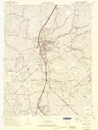
1942 · Princess Anne
USGS Topo · 1:24,000

1942 · Eden
USGS Topo · 1:24,000

1942 · Dividing Creek
USGS Topo · 1:24,000