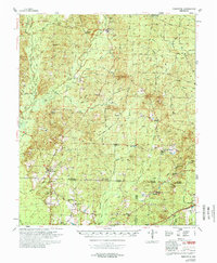
1978 Map of Princeton
USGS Topo · Published 1978About this map
Princeton serves as a central hub in this late-1970s landscape, situated at the junction of several drainage systems including East Fork Red Branch and Stokes Creek. The map documents a dense network of country churches and family-named landmarks that define the social fabric of rural Arkansas, such as Macedonia Ch and St Johns Ch. Industry and infrastructure are concentrated in the southern reaches, where the St Louis Southwestern and Chicago Rock Island and Pacific railroads intersect near Thornton. To the east, the Forrest Banner and a local Fish Hatchery mark specialized land use, while the numerous Gravel Pits scattered near Holly Springs indicate the area's mineral extraction history. This survey captures the region just as modern road networks like Townsend Road and Liberty Road were becoming established through the timberlands and creek bottoms of the South Arkansas interior.
Find a feature on this map
71 named features on this map. Tap any name to fly to it.
Don’t see what you’re looking for? This feature index may not catch every label — zoom into the map to look around manually.
Map Details
Editions of this 1978 Princeton Map
This is the sole edition of this map. No revisions or reprints were ever made.
Other maps of this area

1903 · Camden
USGS Topo · 1:125,000

1953 · El Dorado
USGS Topo · 1:250,000

1955 · Little Rock
USGS Topo · 1:250,000

1956 · Little Rock
USGS Topo · 1:250,000

1957 · El Dorado
USGS Topo · 1:250,000

1958 · El Dorado
USGS Topo · 1:250,000

1960 · El Dorado
USGS Topo · 1:250,000

1960 · Little Rock
USGS Topo · 1:250,000

1964 · Little Rock
USGS Topo · 1:250,000

1964 · Bunn
USGS Topo · 1:24,000