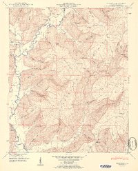
1951 Map of Princeton
USGS Topo · Published 1951About this map
Paint Rock River valley serves as the central artery for this Jackson County landscape, where the confluence of Larkin Fork and Lick Fork at Princeton defines the local geography. The 1951 survey, based on 1940s field examinations by the Tennessee Valley Authority, reveals a rugged terrain dominated by the Cumberland Plateau and Jacobs Mountain. Small agricultural settlements like Hollytree and Little Nashville are linked by a network of local routes such as LR 56, while the higher elevations are marked by distinctive points like Logan Point and Prince Point. The map provides significant genealogical value through its many family-named cemeteries, including Green Cem, Fowler Cem, and Latham Cem. These burial grounds, alongside rural landmarks like Guess Creek Church and Williams Cove Ch, illustrate a deeply rooted community structure established within the narrow coves and along the fertile river bottoms.
Find a feature on this map
78 named features on this map. Tap any name to fly to it.
Don’t see what you’re looking for? This feature index may not catch every label — zoom into the map to look around manually.
Map Details
Editions of this 1951 Princeton Map
2 editions found
Other maps of this area

1888 · Scottsboro
USGS Topo · 1:125,000

1892 · Scottsboro
USGS Topo · 1:125,000

1936 · Scottsboro
USGS Topo · 1:24,000

1936 · King Cove
USGS Topo · 1:24,000

1936 · Hollytree
USGS Topo · 1:24,000

1936 · Mud Creek
USGS Topo · 1:24,000

1936 · Hytop
USGS Topo · 1:24,000

1936 · Princeton
USGS Topo · 1:24,000

1936 · Lim Rock
USGS Topo · 1:24,000
1936 · Paint Rock
USGS Topo · 1:24,000