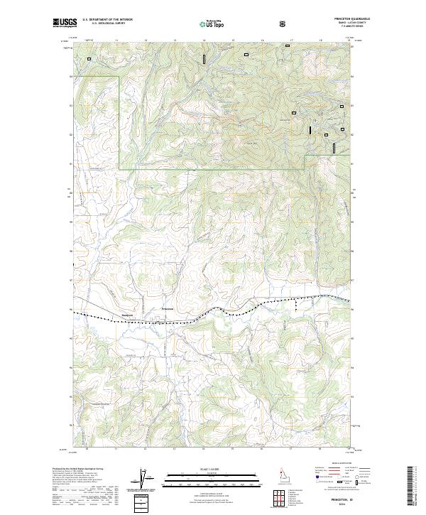
2024 Map of Princeton
USGS Topo · Published 2024About this map
Princeton and Hampton serve as the primary focal points of this Latah County landscape, situated where the Palouse River winds through the valley floor. The geography is defined by a transition from agricultural river bottoms to the elevated timberlands of the St Joe National Forest. Notable peaks such as Gold Hill and East Gold Hill overlook a network of drainage systems including Hatter Creek, Gold Creek, and Crane Creek. The map documents a dense grid of rural corridors like Hatter Creek Rd and Gold Creek Cutoff Rd, which connect outlying homesteads to the river settlements. To the north and east, the terrain becomes increasingly complex as it rises toward the forest boundary, marked by numerous gulches and canyons such as Picnic Gulch, McCoy Gulch, and Heath Gulch. This data illustrates the modern intersection of logging access, riparian management, and rural Idaho residency.
Find a feature on this map
57 named features on this map. Tap any name to fly to it.
Don’t see what you’re looking for? This feature index may not catch every label — zoom into the map to look around manually.
Map Details
Editions of this 2024 Princeton Map
This is the sole edition of this map. No revisions or reprints were ever made.
Other maps of this area

1955 · Pullman
USGS Topo · 1:250,000

1955 · Spokane
USGS Topo · 1:250,000

1957 · Emida
USGS Topo · 1:62,500

1957 · Tensed
USGS Topo · 1:62,500

1958 · Spokane
USGS Topo · 1:250,000

1958 · Pullman
USGS Topo · 1:250,000

1960 · Robinson Lake
USGS Topo · 1:24,000

1960 · Moscow Mtn
USGS Topo · 1:24,000

1960 · Potlatch
USGS Topo · 1:62,500

1961 · Deary
USGS Topo · 1:62,500