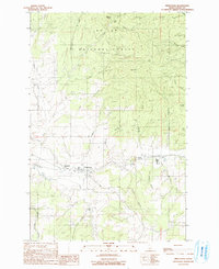
1990 Map of Princeton
USGS Topo · Published 1991About this map
Princeton and Hampton serve as the primary residential hubs along the Palouse River in this 1990 survey of Latah County. The landscape is defined by the steep, timbered ridges of the St Joe National Forest, where historical mining activity is evidenced by the Lost Wheelbarrow Mine and Carrico Mine. This area transitions from the rugged forest highlands in the north, including Gold Hill, down toward the agricultural river valley. The drainage network is particularly dense here, with dozens of named watercourses like Hatter Creek, McCoy Creek, and Camas Creek carving deep gulches such as Treasure Gulch and Garden Gulch. These features reflect a late 20th-century balance between natural resource extraction—marked by several Quarry and Gravel Pit sites—and small-town valley life, offering a clear record of the region's topography before more modern development.
Find a feature on this map
42 named features on this map. Tap any name to fly to it.
Don’t see what you’re looking for? This feature index may not catch every label — zoom into the map to look around manually.
Map Details
Editions of this 1990 Princeton Map
This is the sole edition of this map. No revisions or reprints were ever made.
Other maps of this area

1955 · Pullman
USGS Topo · 1:250,000

1955 · Spokane
USGS Topo · 1:250,000

1957 · Emida
USGS Topo · 1:62,500

1957 · Tensed
USGS Topo · 1:62,500

1958 · Spokane
USGS Topo · 1:250,000

1958 · Pullman
USGS Topo · 1:250,000

1960 · Robinson Lake
USGS Topo · 1:24,000

1960 · Moscow Mtn
USGS Topo · 1:24,000

1960 · Potlatch
USGS Topo · 1:62,500

1961 · Deary
USGS Topo · 1:62,500