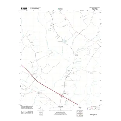
2011 Map of Pringletown
USGS Topo · Published 2011About this map
Four Hole Swamp dominates this landscape, weaving through the rural stretches of Berkeley County near Spring Hill. This 2011 survey documents a region defined by its intersection with history and hydrology, notably the Four Hole Bridge Revolutionary Post located near Pringletown. The area is characterized by a high concentration of family and community landmarks, including Sandridge Cemetery and Springhill Cemetery, which speak to the deep-rooted settlement patterns of the region. The map tracks numerous waterways such as Santee Branch, Rock Branch, and Timothy Creek, as well as engineered features like the South Carolina Noname 08021 D-3463 Dam. These drainage systems and small lakes like Lake Merkel highlight the water-managed environment of the Lowcountry, while local roads like Old Wiggins RD and Beidler Forest RD connect the scattered hamlets and historic sites.
Find a feature on this map
71 named features on this map. Tap any name to fly to it.
Don’t see what you’re looking for? This feature index may not catch every label — zoom into the map to look around manually.
Map Details
Editions of this 2011 Pringletown Map
This is the sole edition of this map. No revisions or reprints were ever made.
Other maps of this area

1919 · Summerville
USGS Topo · 1:48,000

1919 · Ridgeville
USGS Topo · 1:48,000

1920 · Eutawville
USGS Topo · 1:48,000

1920 · Chicora
USGS Topo · 1:48,000

1920 · Ridgeville
USGS Topo · 1:62,500

1920 · Summerville
USGS Topo · 1:62,500

1921 · Chicora
USGS Topo · 1:62,500

1921 · Eutawville
USGS Topo · 1:62,500

1943 · Chicora
USGS Topo · 1:62,500

1943 · Ridgeville
USGS Topo · 1:62,500