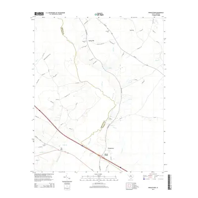
2014 Map of Pringletown
USGS Topo · Published 2014About this map
Four Hole Swamp defines the western corridor of this Lowcountry landscape, winding through the borderlands of Berkeley and Dorchester counties. Small, established settlements like Spring Hill and Pringletown are situated along the historic north-south artery of Old Gilliard Rd, reflecting a rural settlement pattern rooted in local agriculture and timber. The map reveals a dense network of family-named cemeteries, including Sandridge Cem, Springhill Cem, and Mims Lake Cem, which serve as vital markers for genealogical research in this part of South Carolina. The terrain is characterized by wetlands and natural depressions, such as Tupelo Bay and Lake Merkel, while human infrastructure is most prominent at the Four Hole Bridge where Us-78 crosses the primary swamp. This 2014 survey documents the area's continued reliance on its traditional road network and water-bound geography.
Find a feature on this map
61 named features on this map. Tap any name to fly to it.
Don’t see what you’re looking for? This feature index may not catch every label — zoom into the map to look around manually.
Map Details
Editions of this 2014 Pringletown Map
This is the sole edition of this map. No revisions or reprints were ever made.
Other maps of this area

1919 · Summerville
USGS Topo · 1:48,000

1919 · Ridgeville
USGS Topo · 1:48,000

1920 · Eutawville
USGS Topo · 1:48,000

1920 · Chicora
USGS Topo · 1:48,000

1920 · Ridgeville
USGS Topo · 1:62,500

1920 · Summerville
USGS Topo · 1:62,500

1921 · Chicora
USGS Topo · 1:62,500

1921 · Eutawville
USGS Topo · 1:62,500

1943 · Chicora
USGS Topo · 1:62,500

1943 · Ridgeville
USGS Topo · 1:62,500