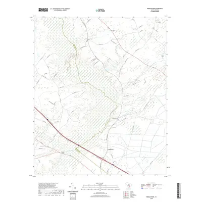
2020 Map of Pringletown
USGS Topo · Published 2020About this map
Pringletown sits within a landscape defined by the sprawling wetlands of Four Hole Swamp, where the boundary between Berkeley and Dorchester counties follows the natural watercourse. This 2020 survey reveals a community deeply tied to its geography, with numerous family and place-named roads such as Music Farm Rd and Old Gilliard Rd weaving through the dense network of bays and branches. These features, including Tupelo Bay and Caton Bay, suggest the low-lying, hydrologically complex nature of the South Carolina Lowcountry.
Find a feature on this map
68 named features on this map. Tap any name to fly to it.
Don’t see what you’re looking for? This feature index may not catch every label — zoom into the map to look around manually.
Map Details
Editions of this 2020 Pringletown Map
This is the sole edition of this map. No revisions or reprints were ever made.
Other maps of this area

1919 · Summerville
USGS Topo · 1:48,000

1919 · Ridgeville
USGS Topo · 1:48,000

1920 · Eutawville
USGS Topo · 1:48,000

1920 · Chicora
USGS Topo · 1:48,000

1920 · Ridgeville
USGS Topo · 1:62,500

1920 · Summerville
USGS Topo · 1:62,500

1921 · Chicora
USGS Topo · 1:62,500

1921 · Eutawville
USGS Topo · 1:62,500

1943 · Chicora
USGS Topo · 1:62,500

1943 · Ridgeville
USGS Topo · 1:62,500