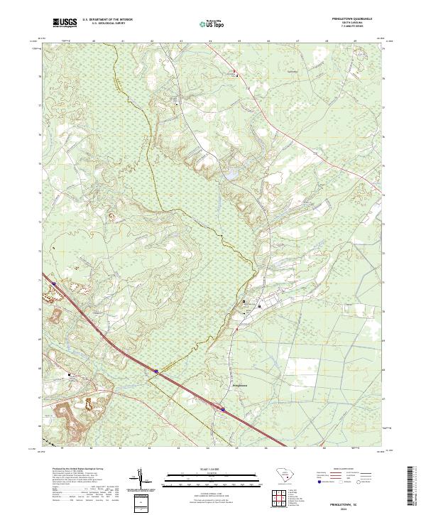
2024 Map of Pringletown
USGS Topo · Published 2024About this map
Pringletown sits at a historic crossroads where the borders of Berkeley and Dorchester counties meet, defined by the extensive wetlands of Four Hole Swamp. This Lowcountry landscape is characterized by its numerous blackwater tributaries and distinctive Carolina bays, such as Tupelo Bay and Caton Bay, which interrupt the pine-forested terrain. The road network, featuring names like Old Gilliard Rd and Old Wiggins Rd, traces long-established routes through the swampy bottomlands.
Find a feature on this map
74 named features on this map. Tap any name to fly to it.
Don’t see what you’re looking for? This feature index may not catch every label — zoom into the map to look around manually.
Map Details
Editions of this 2024 Pringletown Map
This is the sole edition of this map. No revisions or reprints were ever made.
Other maps of this area

1919 · Summerville
USGS Topo · 1:48,000

1919 · Ridgeville
USGS Topo · 1:48,000

1920 · Eutawville
USGS Topo · 1:48,000

1920 · Chicora
USGS Topo · 1:48,000

1920 · Ridgeville
USGS Topo · 1:62,500

1920 · Summerville
USGS Topo · 1:62,500

1921 · Chicora
USGS Topo · 1:62,500

1921 · Eutawville
USGS Topo · 1:62,500

1943 · Chicora
USGS Topo · 1:62,500

1943 · Ridgeville
USGS Topo · 1:62,500