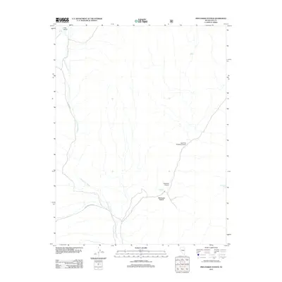
2012 Map of Pritchards Station
USGS Topo · Published 2012About this map
Pritchards Station serves as the focal point for this high-desert landscape in central Nevada, situated where several major drainage systems converge. The terrain is defined by a network of seasonal watercourses, most notably Hicks Station Wash, which transitions into Moores Station Wash as it flows south. The presence of numerous named water sources like Hicks Spring, Bassit Spring, and Burnt Cabin Spring suggests the vital importance of reliable water in this arid environment, likely supporting early livestock operations or travel routes through the region. To the east and west, the topography rises into distinct formations such as Moonshine Canyon and East Fork Pritchard Canyon. This 2012 survey by the U.S. Geological Survey documents the enduring physical landmarks of Nye County, including the curiously named Luther Waddles Wash, providing a clear record of the area's hydrography and remote settlement patterns.
Find a feature on this map
12 named features on this map. Tap any name to fly to it.
Don’t see what you’re looking for? This feature index may not catch every label — zoom into the map to look around manually.
Map Details
Editions of this 2012 Pritchards Station Map
This is the sole edition of this map. No revisions or reprints were ever made.
Other maps of this area

1956 · Tonopah
USGS Topo · 1:250,000

1959 · Tonopah
USGS Topo · 1:250,000

1962 · Tonopah
USGS Topo · 1:250,000

1967 · Moores Station
USGS Topo · 1:62,500

1967 · Moores Station
USGS Topo · 1:24,000

1967 · Chaos Creek
USGS Topo · 1:24,000

1967 · Morey Peak
USGS Topo · 1:24,000

1968 · Morey Peak
USGS Topo · 1:62,500

1968 · Pritchards Station
USGS Topo · 1:62,500

1968 · Fish Springs
USGS Topo · 1:62,500