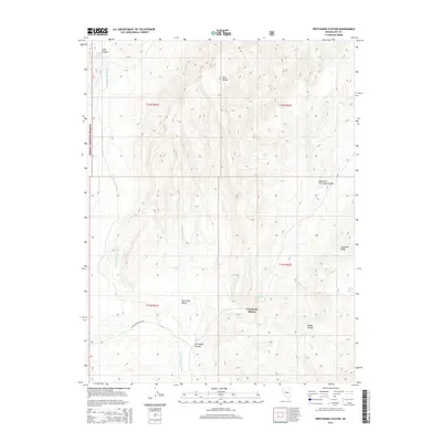
2014 Map of Pritchards Station
USGS Topo · Published 2014About this map
Pritchards Station serves as the namesake hub of this Nevada landscape, where the high desert terrain of Hot Creek Valley meets the rising slopes of the Park Range and the Needle Range. Much of the western territory is managed as part of the Toiyabe National Forest, characterized by steep drainage systems and ephemeral water sources. The map records several vital water points for this arid region, including Hicks Spring, Pritchards Spring, and the evocatively named Burnt Cabin Spring. These springs and the surrounding washes, such as Luther Waddles Wash and Moores Station Wash, dictate the local geography and historical movement through the canyons. Notable geologic formations like Andesite Ridge and East Fork Pritchard Canyon define the area's relief, offering a detailed look at the basin and range topography typical of central Nye County.
Find a feature on this map
20 named features on this map. Tap any name to fly to it.
Don’t see what you’re looking for? This feature index may not catch every label — zoom into the map to look around manually.
Map Details
Editions of this 2014 Pritchards Station Map
This is the sole edition of this map. No revisions or reprints were ever made.
Other maps of this area

1956 · Tonopah
USGS Topo · 1:250,000

1959 · Tonopah
USGS Topo · 1:250,000

1962 · Tonopah
USGS Topo · 1:250,000

1967 · Moores Station
USGS Topo · 1:62,500

1967 · Moores Station
USGS Topo · 1:24,000

1967 · Chaos Creek
USGS Topo · 1:24,000

1967 · Morey Peak
USGS Topo · 1:24,000

1968 · Morey Peak
USGS Topo · 1:62,500

1968 · Pritchards Station
USGS Topo · 1:62,500

1968 · Fish Springs
USGS Topo · 1:62,500