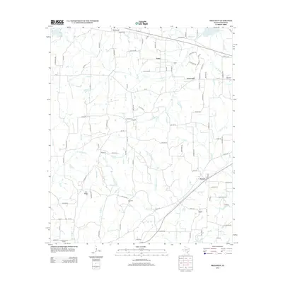
2012 Map of Pritchett
USGS Topo · Published 2012About this map
Pritchett and the surrounding rural communities of Upshur County are mapped here in the early 21st century, revealing a landscape defined by small settlements and an intricate network of creeks. The area is anchored by historic burial sites, including Kelsey Cem near the Kelsey settlement and New Hope Cem to the south. The terrain is marked by gentle elevations like Peter Hayes Hill and numerous watercourses such as Kelsey Cr, Little White Oak Cr, and Pond Cr that feed into the local watershed. In the northern reaches, the edge of Lake Gilmer appears near Rosewood, while the community of Latch sits central to a web of farm-to-market roads and local routes named for native trees like Nutmeg Rd and Pecan Rd. This map captures the persistent rural character of East Texas, where long-established family names and community markers like Pleasant Hill Cem remain the primary landmarks.
Find a feature on this map
99 named features on this map. Tap any name to fly to it.
Don’t see what you’re looking for? This feature index may not catch every label — zoom into the map to look around manually.
Map Details
Editions of this 2012 Pritchett Map
This is the sole edition of this map. No revisions or reprints were ever made.
Other maps of this area

1956 · Tyler
USGS Topo · 1:250,000

1960 · Shady Grove
USGS Topo · 1:24,000

1960 · Hawkins
USGS Topo · 1:24,000

1960 · Big Sandy
USGS Topo · 1:24,000

1960 · Pritchett
USGS Topo · 1:24,000

1960 · Bettie
USGS Topo · 1:24,000

1960 · Gilmer
USGS Topo · 1:24,000

1960 · Thomas
USGS Topo · 1:24,000

1960 · Rhonesboro
USGS Topo · 1:24,000

1960 · Gladewater
USGS Topo · 1:24,000