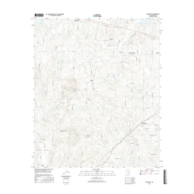
2016 Map of Pritchett
USGS Topo · Published 2016About this map
Pritchett and the surrounding rural communities of Kelsey and Latch define this portion of East Texas, where the landscape is intricately divided by narrow country roads named for local timber and flora. The settlement pattern is anchored by family and community history, evidenced by the presence of Kelsey Cem, New Hope Cem, and Pleasant Hill Cem. Waterways like Little White Oak Cr and Beech Cr drain the terrain toward the northeast, where Lake Gilmer sits on the edge of the survey area. Significant local landmarks such as Peter Hayes Hill and the Crosscut Field in the southwest corner reflect the specific topography and land use of this region. The map captures a network of rural connections, from the northern boundary near Rosewood to the eastern community of Enoch, tracing a tradition of small-town centers linked by farm-to-market routes.
Find a feature on this map
95 named features on this map. Tap any name to fly to it.
Don’t see what you’re looking for? This feature index may not catch every label — zoom into the map to look around manually.
Map Details
Editions of this 2016 Pritchett Map
This is the sole edition of this map. No revisions or reprints were ever made.
Other maps of this area

1956 · Tyler
USGS Topo · 1:250,000

1960 · Shady Grove
USGS Topo · 1:24,000

1960 · Hawkins
USGS Topo · 1:24,000

1960 · Big Sandy
USGS Topo · 1:24,000

1960 · Pritchett
USGS Topo · 1:24,000

1960 · Bettie
USGS Topo · 1:24,000

1960 · Gilmer
USGS Topo · 1:24,000

1960 · Thomas
USGS Topo · 1:24,000

1960 · Rhonesboro
USGS Topo · 1:24,000

1960 · Gladewater
USGS Topo · 1:24,000