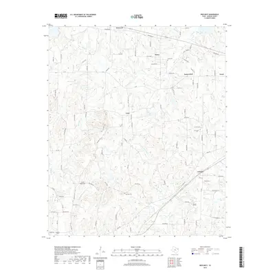
2019 Map of Pritchett
USGS Topo · Published 2019About this map
Pritchett and several smaller rural communities define this portion of the East Texas landscape, characterized by a dendritic drainage network feeding into Little White Oak Cr and Glade Cr. The terrain is marked by numerous family and community landmarks, such as Peter Hayes Hill and the historical site of Kelsey, which remains a focal point for genealogical interest with its nearby Kelsey Cem. The road network is heavily named for local flora and families, with routes like Beechnut Rd and Hackberry Rd weaving through the upland ridges between watercourses like Beech Cr and Ballard Br. Further south, New Hope Cem and Pleasant Hill Cem provide important reference points for those tracing local family roots in this largely agricultural and wooded region. The area's character is further illustrated by distinct features like Crosscut Field and the small settlements of Latch and Enoch.
Find a feature on this map
92 named features on this map. Tap any name to fly to it.
Don’t see what you’re looking for? This feature index may not catch every label — zoom into the map to look around manually.
Map Details
Editions of this 2019 Pritchett Map
This is the sole edition of this map. No revisions or reprints were ever made.
Other maps of this area

1956 · Tyler
USGS Topo · 1:250,000

1960 · Shady Grove
USGS Topo · 1:24,000

1960 · Hawkins
USGS Topo · 1:24,000

1960 · Big Sandy
USGS Topo · 1:24,000

1960 · Pritchett
USGS Topo · 1:24,000

1960 · Bettie
USGS Topo · 1:24,000

1960 · Gilmer
USGS Topo · 1:24,000

1960 · Thomas
USGS Topo · 1:24,000

1960 · Rhonesboro
USGS Topo · 1:24,000

1960 · Gladewater
USGS Topo · 1:24,000