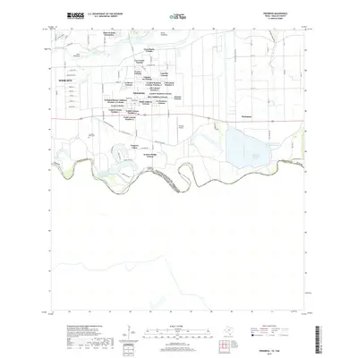
2019 Map of Progreso
USGS Topo · Published 2019About this map
The Rio Grande defines the southern boundary of this border region, snaking through a landscape shaped by hydraulic engineering and specialized residential patterns. Significant infrastructure manages the river's flow, including the Main Floodway and North Floodway, which divert water away from settlements like Progreso and Weslaco. Large-scale water management is further evidenced by the Progreso District Settling Basin and Mercedes District Settling Basin, vital to the agricultural and residential needs of the valley.
Find a feature on this map
84 named features on this map. Tap any name to fly to it.
Don’t see what you’re looking for? This feature index may not catch every label — zoom into the map to look around manually.
Map Details
Editions of this 2019 Progreso Map
This is the sole edition of this map. No revisions or reprints were ever made.
Other maps of this area

1914 · San Juan
USGS Topo · 1:48,000

1916 · San Juan
USGS Topo · 1:62,500

1929 · Santa Maria
USGS Topo · 1:24,000

1929 · La Feria
USGS Topo · 1:24,000

1936 · La Feria
USGS Topo · 1:31,680

1936 · Santa Maria
USGS Topo · 1:31,680

1949 · Mc Allen
USGS Topo · 1:250,000

1953 · Brownsville
USGS Topo · 1:250,000

1954 · McAllen
USGS Topo · 1:250,000
1956 · La Feria
USGS Topo · 1:24,000