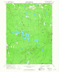
1966 Map of Promised Land
USGS Topo · Published 1968About this map
Promised Land State Park dominates this mid-1960s landscape, centered on the recreation areas and campgrounds surrounding Promised Land Lake. The terrain is defined by a dense network of wetlands and glacial lakes, including Bruce Lake and Egypt Meadow Lake to the north, and Lake Laura to the east. These water bodies are connected by numerous small runs and creeks like Shohola Creek and Blooming Grove Creek, which wind through extensive swamps such as Panther Swamp and Balsam Swamp.
Find a feature on this map
74 named features on this map. Tap any name to fly to it.
Don’t see what you’re looking for? This feature index may not catch every label — zoom into the map to look around manually.
Map Details
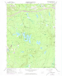
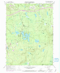
Editions of this 1966 Promised Land Map
3 editions found
Other maps of this area

1919 · Pocono
USGS Topo · 1:62,500

1921 · Pocono
USGS Topo · 1:62,500

1923 · Pocono
USGS Topo · 1:62,500

1924 · Bushkill
USGS Topo · 1:48,000

1928 · Ariel
USGS Topo · 1:62,500

1932 · Ariel
USGS Topo · 1:62,500

1935 · Hawley
USGS Topo · 1:62,500

1938 · Hawley
USGS Topo · 1:62,500

1943 · Bushkill
USGS Topo · 1:62,500

1943 · Pocono
USGS Topo · 1:62,500
Featured Places
- Blooming Grove Township, PA
- Greene Township, PA
- Porter Township, PA
- Tanglewood Estate, Palmyra Township
- Roemersville, Greene Township