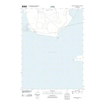
2011 Map of Promontory Point
USGS Topo · Published 2011About this map
The Promontory Mountains rise at the northern edge of this coastal survey, where the terrestrial land meets the vast expanse of the Great Salt Lake. The settlement of Saline and the geographic feature of Promontory Point represent the primary points of human activity along the southern tip of the peninsula. This environment is defined by its distinct hydrological boundaries, where the main lake body is segmented into Bear River Bay, Ogden Bay, and Gilbert Bay. Access is dominated by East Promontory Rd, which traces the shoreline and provides the only terrestrial link to these remote outposts. Further into the water, Fremont Island emerges with its prominent Miller Point, offering a unique perspective on the isolation and specific geography of the Great Salt Lake's island system in the early twenty-first century.
Find a feature on this map
10 named features on this map. Tap any name to fly to it.
Don’t see what you’re looking for? This feature index may not catch every label — zoom into the map to look around manually.
Map Details
Editions of this 2011 Promontory Point Map
This is the sole edition of this map. No revisions or reprints were ever made.
Other maps of this area

1954 · Brigham City
USGS Topo · 1:250,000

1955 · Willard Spur
USGS Topo · 1:24,000

1955 · Fremont Island
USGS Topo · 1:24,000

1958 · Brigham City
USGS Topo · 1:250,000

1962 · Brigham City
USGS Topo · 1:250,000

1968 · Indian Cove
USGS Topo · 1:24,000

1968 · Pokes Point
USGS Topo · 1:24,000

1968 · Promontory Point
USGS Topo · 1:24,000

1968 · Fremont Island SW
USGS Topo · 1:24,000

1968 · Carrington Island
USGS Topo · 1:24,000