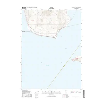
2017 Map of Promontory Point
USGS Topo · Published 2017About this map
The Promontory Mountains terminate at the northern edge of the Great Salt Lake, where the land narrows into the iconic Promontory Point. This map captures the industrial and geographic intersection at Saline, a site defined by the Southern Pacific Causeway as it cuts across the water toward the western shore. To the southeast, the isolated terrain of Fremont Island emerges from the lake, featuring Miller Point and the sheltered Fremont Bight.
Find a feature on this map
11 named features on this map. Tap any name to fly to it.
Don’t see what you’re looking for? This feature index may not catch every label — zoom into the map to look around manually.
Map Details
Editions of this 2017 Promontory Point Map
This is the sole edition of this map. No revisions or reprints were ever made.
Other maps of this area

1954 · Brigham City
USGS Topo · 1:250,000

1955 · Willard Spur
USGS Topo · 1:24,000

1955 · Fremont Island
USGS Topo · 1:24,000

1958 · Brigham City
USGS Topo · 1:250,000

1962 · Brigham City
USGS Topo · 1:250,000

1968 · Indian Cove
USGS Topo · 1:24,000

1968 · Pokes Point
USGS Topo · 1:24,000

1968 · Promontory Point
USGS Topo · 1:24,000

1968 · Fremont Island SW
USGS Topo · 1:24,000

1968 · Carrington Island
USGS Topo · 1:24,000