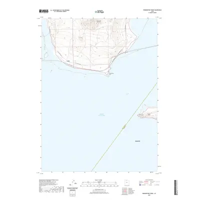
2020 Map of Promontory Point
USGS Topo · Published 2020About this map
The Promontory Mountains descend toward the salt-crusted shores where the Great Salt Lake meets the land at the southernmost tip of the peninsula. This area is defined by the industrial and geographical significance of Saline and the physical landmark of Promontory Point, providing a record of the transportation corridors that skirt the shoreline, such as S East Promontory Rd. Across the Fremont Strait, the topography of Fremont Island is visible, featuring landmarks like Miller Point and Fremont Bight. The map also delineates the administrative boundary between Box Elder Co and Weber Co cutting through the open water of the Great Salt Lake toward the settlement of Hooper.
Find a feature on this map
12 named features on this map. Tap any name to fly to it.
Don’t see what you’re looking for? This feature index may not catch every label — zoom into the map to look around manually.
Map Details
Editions of this 2020 Promontory Point Map
This is the sole edition of this map. No revisions or reprints were ever made.
Other maps of this area

1954 · Brigham City
USGS Topo · 1:250,000

1955 · Willard Spur
USGS Topo · 1:24,000

1955 · Fremont Island
USGS Topo · 1:24,000

1958 · Brigham City
USGS Topo · 1:250,000

1962 · Brigham City
USGS Topo · 1:250,000

1968 · Indian Cove
USGS Topo · 1:24,000

1968 · Pokes Point
USGS Topo · 1:24,000

1968 · Promontory Point
USGS Topo · 1:24,000

1968 · Fremont Island SW
USGS Topo · 1:24,000

1968 · Carrington Island
USGS Topo · 1:24,000