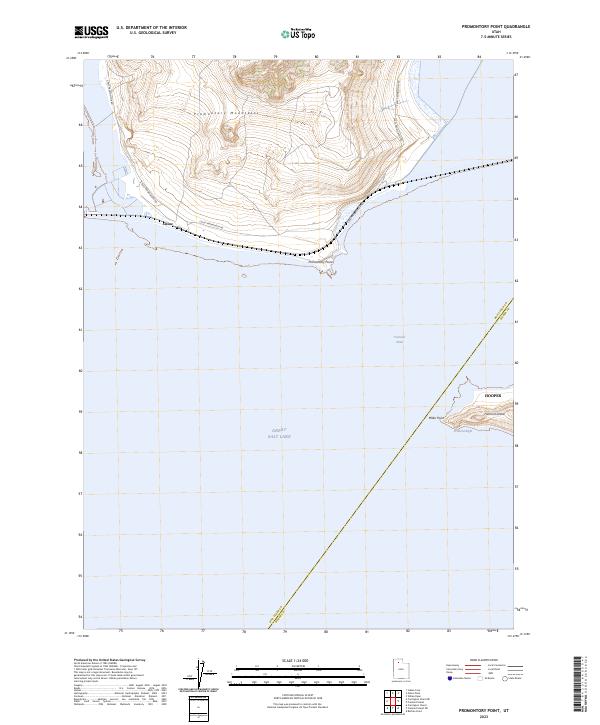
2023 Map of Promontory Point
USGS Topo · Published 2023About this map
Promontory Mountains rise sharply above the northern reaches of the Great Salt Lake, terminating at the landform of Promontory Point. This peninsula is a critical junction for the region's transport and physical geography, where the S East Promontory Rd skirts the coastline near the small settlement of Saline. The map provides a detailed view of the water and land interaction, specifically across the Fremont Strait toward the isolated terrain of Fremont Island.
Find a feature on this map
11 named features on this map. Tap any name to fly to it.
Don’t see what you’re looking for? This feature index may not catch every label — zoom into the map to look around manually.
Map Details
Editions of this 2023 Promontory Point Map
This is the sole edition of this map. No revisions or reprints were ever made.
Other maps of this area

1954 · Brigham City
USGS Topo · 1:250,000

1955 · Willard Spur
USGS Topo · 1:24,000

1955 · Fremont Island
USGS Topo · 1:24,000

1958 · Brigham City
USGS Topo · 1:250,000

1962 · Brigham City
USGS Topo · 1:250,000

1968 · Indian Cove
USGS Topo · 1:24,000

1968 · Pokes Point
USGS Topo · 1:24,000

1968 · Promontory Point
USGS Topo · 1:24,000

1968 · Fremont Island SW
USGS Topo · 1:24,000

1968 · Carrington Island
USGS Topo · 1:24,000