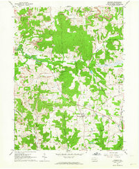
1961 Map of Prospect
USGS Topo · Published 1964About this map
The borough of Prospect stands as a central hub in this western Butler County landscape, situated where local routes converge near the County Fairgrounds. During the early 1960s, the surrounding countryside was a mosaic of traditional agriculture and emerging industrial activity, characterized by numerous Oil Wells and extensive Strip Mines concentrated west of the village. The terrain is defined by the winding course of Muddy Creek and high points like Whippoorwill Hill, while transportation patterns are marked by the presence of an Old Railroad Grade that speaks to the area's earlier logistical history. Local life is centered around several rural institutions, including the St Johns Stone Ch and small schools like the Dick Sch, which served the scattered communities of West Liberty and Whitestown during this era of post-war transition.
Find a feature on this map
53 named features on this map. Tap any name to fly to it.
Don’t see what you’re looking for? This feature index may not catch every label — zoom into the map to look around manually.
Map Details
Editions of this 1961 Prospect Map
Other maps of this area

1908 · Zelienople
USGS Topo · 1:62,500

1909 · Butler
USGS Topo · 1:62,500

1910 · Zelienople
USGS Topo · 1:62,500

1910 · Hilliards
USGS Topo · 1:62,500

1911 · Butler
USGS Topo · 1:62,500

1912 · Hilliards
USGS Topo · 1:62,500

1913 · Mercer
USGS Topo · 1:62,500

1939 · Mercer
USGS Topo · 1:62,500

1943 · Mercer
USGS Topo · 1:62,500

1944 · Hilliards
USGS Topo · 1:62,500