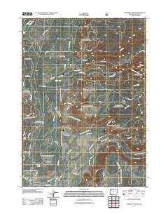
2011 Map of Prospect North
USGS Topo · Published 2011About this map
The Rogue River carves through the landscape of the southern Oregon Cascades near the settlement of Prospect, dominated by the managed woodlands of the Rogue River National Frst. This 2011 survey details a complex network of forestry roads such as Huckleberry Rd and Matson Mill Rd that penetrate the dense drainage systems of Red Blanket Creek, Ginkgo Creek, and Barr Creek. The map documents local infrastructure including the North Fork Diversion Dam and the Prospect Sanitary Landfill, alongside community landmarks like the Union Rogue Church Camp and the Prospect Post Office. Distinctive geological and recreational features are evident, from the dramatic Takelma Gorge to the seasonal dwellings at Skeeters Camp. The confluence of numerous named waterways, including Dead Soldier Creek and Lick Creek, reflects the rugged hydrology of Jackson County.
Find a feature on this map
46 named features on this map. Tap any name to fly to it.
Don’t see what you’re looking for? This feature index may not catch every label — zoom into the map to look around manually.
Map Details
Editions of this 2011 Prospect North Map
This is the sole edition of this map. No revisions or reprints were ever made.
Other maps of this area

1891 · Ashland
USGS Topo · 1:250,000

1893 · Ashland
USGS Topo · 1:250,000

1897 · Ashland
USGS Topo · 1:250,000

1944 · Abbott Butte
USGS Topo · 1:62,500

1947 · Abbott Butte
USGS Topo · 1:62,500

1954 · Butte Falls
USGS Topo · 1:62,500

1955 · Rustler Peak
USGS Topo · 1:62,500

1955 · Medford
USGS Topo · 1:250,000

1956 · Prospect
USGS Topo · 1:62,500

1957 · Medford
USGS Topo · 1:250,000