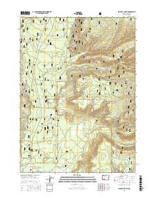
2017 Map of Prospect North
USGS Topo · Published 2017About this map
The Rogue River flows through the western edge of this territory, carving the distinctive Takelma Gorge as it moves south toward the town of Prospect. Much of the landscape is defined by the Rogue River National Forest, where a dense network of forest service roads and drainage systems crisscross the terrain. Water management is a central feature of the local geography, evidenced by the N Fork Diversion Reservoir and Red Blanket Reservoir, which collect flow from numerous tributaries like Mill Cr, Barr Cr, and Red Blanket Cr. For those researching local pioneers and settlers, the Aiken Family Plot is situated near the junction of several drainage basins in the southern portion of the sheet. This area reflects a mid-20th-century focus on timber management and hydraulic resources, with a complex system of fire roads and named ridges.
Find a feature on this map
39 named features on this map. Tap any name to fly to it.
Don’t see what you’re looking for? This feature index may not catch every label — zoom into the map to look around manually.
Map Details
Editions of this 2017 Prospect North Map
This is the sole edition of this map. No revisions or reprints were ever made.
Other maps of this area

1891 · Ashland
USGS Topo · 1:250,000

1893 · Ashland
USGS Topo · 1:250,000

1897 · Ashland
USGS Topo · 1:250,000

1944 · Abbott Butte
USGS Topo · 1:62,500

1947 · Abbott Butte
USGS Topo · 1:62,500

1954 · Butte Falls
USGS Topo · 1:62,500

1955 · Rustler Peak
USGS Topo · 1:62,500

1955 · Medford
USGS Topo · 1:250,000

1956 · Prospect
USGS Topo · 1:62,500

1957 · Medford
USGS Topo · 1:250,000