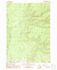
1989 Map of Prospect North
USGS Topo · Published 1990About this map
The Rogue River carves through the landscape of the Cascades in this late-1980s survey, defined by dramatic elevation changes and a dense network of mountain drainage. Near the southern edge, the settlement at Prospect PO and the nearby Ranger Sta serve as focal points for regional activity within the surrounding National Forest. This area is characterized by a reliance on the river system for both recreation and industry, evidenced by the numerous campgrounds and the presence of a Flume and several 4wd trails that provide access into the steep terrain.
Find a feature on this map
31 named features on this map. Tap any name to fly to it.
Don’t see what you’re looking for? This feature index may not catch every label — zoom into the map to look around manually.
Map Details
Editions of this 1989 Prospect North Map
This is the sole edition of this map. No revisions or reprints were ever made.
Other maps of this area

1891 · Ashland
USGS Topo · 1:250,000

1893 · Ashland
USGS Topo · 1:250,000

1897 · Ashland
USGS Topo · 1:250,000

1944 · Abbott Butte
USGS Topo · 1:62,500

1947 · Abbott Butte
USGS Topo · 1:62,500

1954 · Butte Falls
USGS Topo · 1:62,500

1955 · Rustler Peak
USGS Topo · 1:62,500

1955 · Medford
USGS Topo · 1:250,000

1956 · Prospect
USGS Topo · 1:62,500

1957 · Medford
USGS Topo · 1:250,000