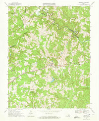
1967 Map of Prospect
USGS Topo · Published 1972About this map
Norfolk and Western tracks bisect this central Virginia landscape, connecting the rural communities of Prospect and Elam during the late 1960s. The terrain is defined by a dense network of drainage, where Vaughans Creek and Plum Creek flow north toward the Appomattox River, which serves as the county boundary with Buckingham. This area reflects a deep-rooted rural social fabric, evidenced by numerous small congregations such as St James Ch, Olive Branch Ch, and Sulphur Spring Ch. Historical river crossings like Beazley Ford and Venables Bridge indicate older transportation patterns that predated the modern road network. To the south, Allens Mill and Grand View Lake highlight the importance of local water resources and early industry in Prince Edward County.
Find a feature on this map
30 named features on this map. Tap any name to fly to it.
Don’t see what you’re looking for? This feature index may not catch every label — zoom into the map to look around manually.
Map Details
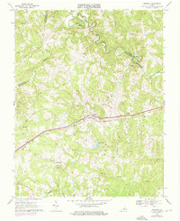
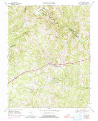
Editions of this 1967 Prospect Map
3 editions found
Other maps of this area

1891 · Farmville
USGS Topo · 1:125,000

1892 · Appomattox
USGS Topo · 1:125,000

1893 · Farmville
USGS Topo · 1:125,000

1947 · Roanoke
USGS Topo · 1:250,000

1956 · Charlotte Court House
USGS Topo · 1:62,500

1958 · Farmville
USGS Topo · 1:62,500

1958 · Keysville
USGS Topo · 1:62,500

1958 · Pamplin City
USGS Topo · 1:62,500

1959 · Roanoke
USGS Topo · 1:250,000

1963 · Roanoke
USGS Topo · 1:250,000