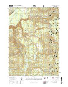
2017 Map of Prospect South
USGS Topo · Published 2017About this map
The Rogue River and its intricate network of tributaries define this section of the Cascade Range, where the settlement of Prospect serves as a northern gateway. The landscape is marked by dramatic hydrological features, including the towering Barr Creek Falls and Mill Creek Falls, where water drops toward the river canyon. Industrial and transit history is etched into the terrain through a dense grid of timber-access and forest roads, such as the Butte Falls-Prospect Rd and Medco A Rd, which connect remote clearings like Carney Flat and Elk Glade. Small-scale infrastructure is visible at the Prospect State Airport, while the southern reaches of the Rogue River National Forest encompass topographic landmarks like Boundary Butte and the curiously named Dead Dog Gulch. This 2017 survey reflects a region where forestry, aviation, and wilderness recreation intersect.
Find a feature on this map
59 named features on this map. Tap any name to fly to it.
Don’t see what you’re looking for? This feature index may not catch every label — zoom into the map to look around manually.
Map Details
Editions of this 2017 Prospect South Map
This is the sole edition of this map. No revisions or reprints were ever made.
Other maps of this area

1891 · Ashland
USGS Topo · 1:250,000

1893 · Ashland
USGS Topo · 1:250,000

1897 · Ashland
USGS Topo · 1:250,000

1944 · Abbott Butte
USGS Topo · 1:62,500

1947 · Abbott Butte
USGS Topo · 1:62,500

1954 · Butte Falls
USGS Topo · 1:62,500

1955 · Rustler Peak
USGS Topo · 1:62,500

1955 · Medford
USGS Topo · 1:250,000

1956 · Prospect
USGS Topo · 1:62,500

1957 · Medford
USGS Topo · 1:250,000