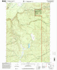
1997 Map of Prospect South
USGS Topo · Published 2000About this map
Prospect serves as the gateway to the upper reaches of the Cascade Range in this late 20th-century revision, where the infrastructure of timber and water management dominates the landscape. The Rogue River National Forest encompasses much of the territory, shaped by natural and industrial forces. Evidence of the region’s active forest history is visible in the vast Reinecke Burn and Zimmerman Burn scars, while the Mill-Mar Ranch and Medco Pond indicate settled agricultural and logging-related uses in the high country.
Find a feature on this map
43 named features on this map. Tap any name to fly to it.
Don’t see what you’re looking for? This feature index may not catch every label — zoom into the map to look around manually.
Map Details
Editions of this 1997 Prospect South Map
This is the sole edition of this map. No revisions or reprints were ever made.
Other maps of this area

1891 · Ashland
USGS Topo · 1:250,000

1893 · Ashland
USGS Topo · 1:250,000

1897 · Ashland
USGS Topo · 1:250,000

1944 · Abbott Butte
USGS Topo · 1:62,500

1947 · Abbott Butte
USGS Topo · 1:62,500

1954 · Butte Falls
USGS Topo · 1:62,500

1955 · Rustler Peak
USGS Topo · 1:62,500

1955 · Medford
USGS Topo · 1:250,000

1956 · Prospect
USGS Topo · 1:62,500

1957 · Medford
USGS Topo · 1:250,000