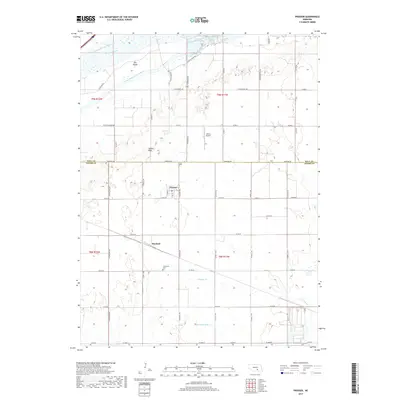
2017 Map of Prosser
USGS Topo · Published 2017About this map
Prosser and Hayland sit at the center of this 2017 survey on the border of Hall and Adams counties. The landscape is defined by the braided channels of the Platte River, including the Middle Channel Platte River and South Channel Platte River, which create large landforms like Elm Island. This area of the Great Plains features a highly organized section-line road grid, including Barrows Rd and N Prosser Ave, which connect remote farmsteads to local hubs. Further south, the drainage patterns shift towards prairie creeks such as Pawnee Creek and Thirtytwo Mile Creek. Genealogists and local historians can locate Concordia Cemetery south of Hayland, while aviation interest is represented by Aknux Airport located north of the county line. The terrain remains relatively level, though subtle elevation changes are marked by features like Topeka Peak.
Find a feature on this map
46 named features on this map. Tap any name to fly to it.
Don’t see what you’re looking for? This feature index may not catch every label — zoom into the map to look around manually.
Map Details
Editions of this 2017 Prosser Map
This is the sole edition of this map. No revisions or reprints were ever made.
Other maps of this area

1892 · Grand Island
USGS Topo · 1:62,500

1894 · Kenesaw
USGS Topo · 1:62,500

1895 · Grand Island
USGS Topo · 1:62,500

1895 · Wood River
USGS Topo · 1:62,500

1896 · Wood River
USGS Topo · 1:125,000

1898 · Grand Island
USGS Topo · 1:125,000

1955 · Grand Island
USGS Topo · 1:250,000

1957 · Grand Island
USGS Topo · 1:250,000

1958 · Grand Island
USGS Topo · 1:250,000

1962 · Denman
USGS Topo · 1:24,000