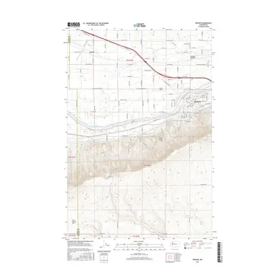
2017 Map of Prosser
USGS Topo · Published 2017About this map
The Yakima River defines the central corridor of this region, separating the developed valley floors from the rising elevations of the Horse Heaven Hills to the south. This landscape is a complex network of water management, vital to the local agricultural economy, featuring the Sunnyside Canal, Mabton Feeder Canal, and Mabton E Lateral winding through the terrain. The city of Prosser serves as the primary hub, supported by the outlying areas of North Prosser and the small settlement at Apricot.
Find a feature on this map
52 named features on this map. Tap any name to fly to it.
Don’t see what you’re looking for? This feature index may not catch every label — zoom into the map to look around manually.
Map Details
Editions of this 2017 Prosser Map
This is the sole edition of this map. No revisions or reprints were ever made.
Other maps of this area

1915 · Prosser
USGS Topo · 1:125,000

1917 · Prosser
USGS Topo · 1:125,000

1950 · Grandview
USGS Topo · 1:62,500

1951 · Grandview
USGS Topo · 1:62,500

1951 · Corral Canyon
USGS Topo · 1:62,500

1953 · Walla Walla
USGS Topo · 1:250,000

1955 · Prosser SW
USGS Topo · 1:24,000

1958 · Walla Walla
USGS Topo · 1:250,000

1965 · Whitstran
USGS Topo · 1:62,500
1965 · Prosser
USGS Topo · 1:62,500