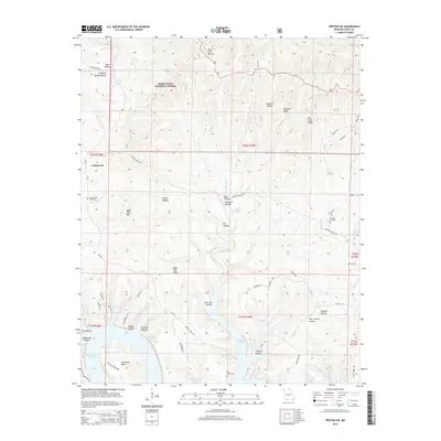
2015 Map of Protem SW
USGS Topo · Published 2015About this map
The settlement of Cedarcreek anchors the northwest corner of this Taney County landscape, where the southern reaches of the Mark Twain National Forest meet the convoluted shoreline of Bull Shoals Lake. This 2015 topography reveals a rugged terrain defined by deeply incised drainages and named ridges, including Cardwell Ridge and Mill Trail Ridge. Local family names are etched into the geography through landmarks such as John Hollow, Hankins Hollow, and Poor Joe Hollow. For genealogists, the map provides precise locations for the Cedar Creek Cemetery, Hankins Cemetery, and Ray Cemetery, which are tucked away in the draws and near the lake's edge. The presence of Lime Kiln Mtn suggests historical industry, while the complex system of forest roads like Bright Elbow Rd and Nave Ferry Rd illustrates the modern accessibility of this once-remote White River region.
Find a feature on this map
62 named features on this map. Tap any name to fly to it.
Don’t see what you’re looking for? This feature index may not catch every label — zoom into the map to look around manually.
Map Details
Editions of this 2015 Protem SW Map
This is the sole edition of this map. No revisions or reprints were ever made.
Other maps of this area

1893 · Yellville
USGS Topo · 1:125,000

1903 · Yellville
USGS Topo · 1:125,000

1904 · Harrison
USGS Topo · 1:125,000

1905 · Harrison
USGS Topo · 1:125,000

1905 · Yellville
USGS Topo · 1:125,000

1907 · Forsyth
USGS Topo · 1:125,000

1929 · Yellville
USGS Topo · 1:125,000

1943 · Protem
USGS Topo · 1:62,500

1945 · Harrison
USGS Topo · 1:250,000

1949 · Harrison
USGS Topo · 1:250,000