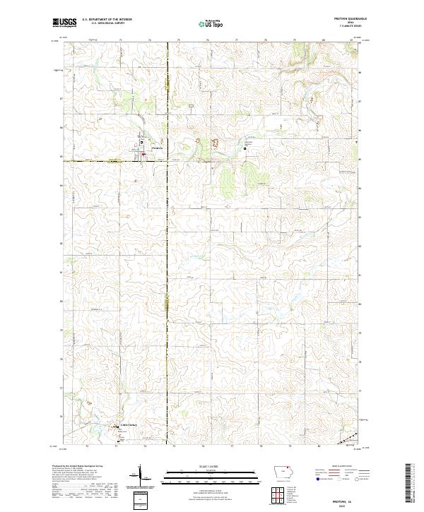
2022 Map of Protivin
USGS Topo · Published 2022About this map
Protivin anchors the northern reaches of this rural landscape where Howard, Winneshiek, and Chickasaw counties converge. Settled atop a grid of local roads including Co RD b16 and 100th ST, the community is characterized by its spiritual and social center, notably the Holy Trinity Cem. To the south, the village of Little Turkey rests near the banks of the Little Turkey River, accompanied by Little Turkey Cem and Saint Marys Cem. The terrain is defined by a dendritic network of waterways, with Bohemian Cr and Wonder Cr carving through the agricultural land. The map highlights the enduring presence of specific cultural landmarks, such as the Bohemian National Cem, which speaks to the heritage of the early residents who established these farming communities in the fertile Driftless-adjacent region of northeast Iowa.
Find a feature on this map
34 named features on this map. Tap any name to fly to it.
Don’t see what you’re looking for? This feature index may not catch every label — zoom into the map to look around manually.
Map Details
Editions of this 2022 Protivin Map
This is the sole edition of this map. No revisions or reprints were ever made.
Other maps of this area

1906 · Decorah
USGS Topo · 1:125,000

1954 · Mason City
USGS Topo · 1:250,000

1957 · Mason City
USGS Topo · 1:250,000

1958 · Mason City
USGS Topo · 1:250,000

1958 · La Crosse
USGS Topo · 1:250,000

1961 · La Crosse
USGS Topo · 1:250,000

1965 · La Crosse
USGS Topo · 1:250,000

1975 · Decorah 3 NW
USGS Topo · 1:24,000

1975 · Decorah 2 SW
USGS Topo · 1:24,000

1976 · La Crosse
USGS Topo · 1:250,000