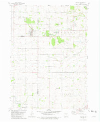
1981 Map of Protivin
USGS Topo · Published 1982About this map
The town of Protivin serves as a central hub on this Northeast Iowa landscape, situated near the intersection of several county lines. The community character is deeply connected to its water sources, with Bohemian Creek winding through the northern sections and the Little Turkey River defining the southern reaches near the settlement of Little Turkey. This survey captures the agricultural and local infrastructure of the early 1980s, documenting landmarks such as the St Marys Ch and its associated Townhall.
Find a feature on this map
23 named features on this map. Tap any name to fly to it.
Don’t see what you’re looking for? This feature index may not catch every label — zoom into the map to look around manually.
Map Details
Editions of this 1981 Protivin Map
This is the sole edition of this map. No revisions or reprints were ever made.
Other maps of this area

1906 · Decorah
USGS Topo · 1:125,000

1954 · Mason City
USGS Topo · 1:250,000

1957 · Mason City
USGS Topo · 1:250,000

1958 · Mason City
USGS Topo · 1:250,000

1958 · La Crosse
USGS Topo · 1:250,000

1961 · La Crosse
USGS Topo · 1:250,000

1965 · La Crosse
USGS Topo · 1:250,000

1975 · Decorah 3 NW
USGS Topo · 1:24,000

1975 · Decorah 2 SW
USGS Topo · 1:24,000

1976 · La Crosse
USGS Topo · 1:250,000