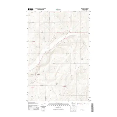
2013 Map of Providence
USGS Topo · Published 2013About this map
Providence stands as a focal point in this portion of Adams County, situated amidst the dramatic geography of the Channeled Scablands. The landscape is defined by its coulees—deep, dry canyons carved by prehistoric floods—most notably Lind Coulee in the northeast and the intersection of Providence Coulee and Cunningham Coulee to the south.
Find a feature on this map
24 named features on this map. Tap any name to fly to it.
Don’t see what you’re looking for? This feature index may not catch every label — zoom into the map to look around manually.
Map Details
Editions of this 2013 Providence Map
This is the sole edition of this map. No revisions or reprints were ever made.
Other maps of this area

1916 · Connell
USGS Topo · 1:125,000

1918 · Connell
USGS Topo · 1:125,000

1925 · Schrag
USGS Topo · 1:62,500

1953 · Walla Walla
USGS Topo · 1:250,000

1953 · Ritzville
USGS Topo · 1:250,000

1958 · Walla Walla
USGS Topo · 1:250,000

1959 · Ritzville
USGS Topo · 1:250,000

1965 · Ritzville
USGS Topo · 1:250,000

1967 · Reiman SW
USGS Topo · 1:24,000
1967 · Schrag
USGS Topo · 1:24,000