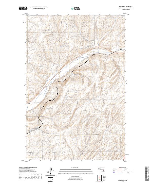
2023 Map of Providence
USGS Topo · Published 2023About this map
Providence and the small siding of Servia sit along the winding drainage of Providence Coulee in this contemporary topographical view of rural Adams County. The landscape is defined by the significant geological depressions of Lind Coulee and Cunningham Coulee, which cut through the agricultural plateaus of the Columbia Basin. A prominent feature of the modern terrain is the Palouse To Cascades State Park Trl, which follows a decommissioned rail corridor through the heart of the region. The map illustrates a strictly organized grid of local connectors, including Lind-Hatton Rd and Lind-Warden Rd, which link remote farmsteads and former rail stops across several townships. This survey records a transition from traditional rail-based settlement to a landscape primarily dedicated to large-scale dryland farming and recreational trail use.
Find a feature on this map
30 named features on this map. Tap any name to fly to it.
Don’t see what you’re looking for? This feature index may not catch every label — zoom into the map to look around manually.
Map Details
Editions of this 2023 Providence Map
This is the sole edition of this map. No revisions or reprints were ever made.
Other maps of this area

1916 · Connell
USGS Topo · 1:125,000

1918 · Connell
USGS Topo · 1:125,000

1925 · Schrag
USGS Topo · 1:62,500

1953 · Walla Walla
USGS Topo · 1:250,000

1953 · Ritzville
USGS Topo · 1:250,000

1958 · Walla Walla
USGS Topo · 1:250,000

1959 · Ritzville
USGS Topo · 1:250,000

1965 · Ritzville
USGS Topo · 1:250,000

1967 · Reiman SW
USGS Topo · 1:24,000
1967 · Schrag
USGS Topo · 1:24,000