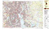
1987 Map of Providence
USGS Topo · Published 1987About this map
Providence serves as the dense urban core of this 1987 study, where the Woonasquatucket River and Seekonk River converge into the Providence River. The map illustrates a mature metropolitan landscape defined by major transit corridors like Interstate 95 and the Conrail lines, yet it preserves the distinct identities of historic neighborhoods and mill villages such as Allendale, Manton, and Olneyville. Institutional landmarks are prominent, including Brown University, Providence College, and the State Capitol, while the extensive grounds of Swan Point Cem and Riverside Cem occupy the riverbanks north of the city center. To the east and south, the map details the suburban and industrial expansion into East Providence, Cranston, and Pawtucket, showcasing a shoreline lined with piers and coves like Watchemoket Cove and Stillhouse Cove.
Find a feature on this map
153 named features on this map. Tap any name to fly to it.
Don’t see what you’re looking for? This feature index may not catch every label — zoom into the map to look around manually.
Map Details
Editions of this 1987 Providence Map
2 editions found
Other maps of this area

1885 · Taunton
USGS Topo · 1:62,500

1887 · Providence
USGS Topo · 1:62,500

1888 · Fall River
USGS Topo · 1:62,500

1888 · Taunton
USGS Topo · 1:62,500

1889 · Providence
USGS Topo · 1:62,500

1889 · Burrillville
USGS Topo · 1:62,500

1890 · Narragansett Bay
USGS Topo · 1:62,500

1890 · Kent
USGS Topo · 1:62,500

1892 · Narragansett Bay
USGS Topo · 1:62,500

1893 · Taunton
USGS Topo · 1:62,500