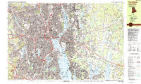
1987 Map of Providence
USGS Topo · Published 1987About this map
Providence and its industrial suburbs are captured here during the late 1980s, revealing a landscape defined by the convergence of the Woonasquatucket River and Seekonk River. The urban core is anchored by the State Capitol and the academic campuses of Brown University and Providence College, while the surrounding residential fabric reaches out to established neighborhoods like Edgewood and Knightsville. Along the Providence River, the map details the maritime infrastructure of Providence Harbor and the Sassafras Pier, marking the transition from the city's dense street grid to the open waters of the bay.
Find a feature on this map
175 named features on this map. Tap any name to fly to it.
Don’t see what you’re looking for? This feature index may not catch every label — zoom into the map to look around manually.
Map Details
Editions of this 1987 Providence Map
2 editions found
Other maps of this area

1885 · Taunton
USGS Topo · 1:62,500

1887 · Providence
USGS Topo · 1:62,500

1888 · Fall River
USGS Topo · 1:62,500

1888 · Taunton
USGS Topo · 1:62,500

1889 · Providence
USGS Topo · 1:62,500

1889 · Burrillville
USGS Topo · 1:62,500

1890 · Narragansett Bay
USGS Topo · 1:62,500

1890 · Kent
USGS Topo · 1:62,500

1892 · Narragansett Bay
USGS Topo · 1:62,500

1893 · Taunton
USGS Topo · 1:62,500